 |
 |
|
| Log
#15
Crossing Queen Charlotte Sound, Taming the Rapids of Johnstone Strait,
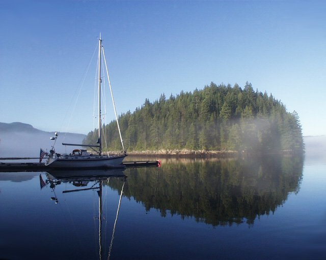
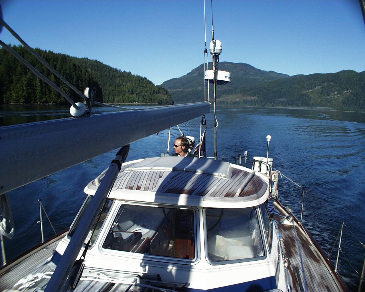
Back to Seattle Crossing Queen Charlotte Sound Saturday August 21, 1999 Returning back to the safety of Rose Harbor on the Queen Charlotte Islands, after getting pounded on the pervious day in six foot washing machine chop, we sat tight all day Saturday, watching another low pressure system blow over. This cold, gray, rainy, blustery day forced J. Mark, Karen, and me into the cabin. Most of the time we read books, but occasionally opened the hatch to watch the fast low-lying clouds shoot overhead. Around 1400 the adjacent sailboat, tied off to the neighboring mooring buoy, hailed us by voice. John and Linda Winnie, in their sailboat Gavia (Ga'-vee-a), invited us for "tea and cake" at 1600. At 1555 the three of us piled into the dinghy for the rain-soaked row 100 feet or so over to Gavia. Linda had prepared an upside down cake, from scratch, in addition to hot tea. Tea and cakes, just as promised. The conversation opened with a discussion about faulty and unreliable sailboat components, followed by general complaints about the weather. That led into a brief backgrounder on our respective personal histories, interests, and plans, and concluded with a discussion about weather strategy for tomorrow's proposed crossing. Andanté and Gavia both planned to attempt the Queen Charlotte Sound. Our evening was more eventful than the day. Some folks hailed August 21st--the day that the GPS satellite system 'rolled-over'--as the practice session for New Years Eve 1999. The military designed the GPS system, which started operating in January 1980, with the ability to record time for only 1,024 weeks. At 23:59:47 GMT on August 21st, the system's software ran out of days and started counting over from zero again. The problem wasn't in the system software, but rather in the millions of receivers in use worldwide. Of the 10 to 15 million units in use, up to 1.5 million were expected to fail or start producing dangerously unreliable data. Andanté's primary GPS is part of the on-board Autohelm ST50 system, which also provides speed and depth, as well as wind speed and direction. We switched on the GPS system at 1700 (midnight Greenwich Mean Time) and discovered that the Autohelm GPS handled the roll-over without a glitch. Our back-up system, a Garmin 175 hand-held, also passed the roll-over test flawlessly. In Andanté's abandon ship bag, however, an older Garmin 45 lies dormant in anticipation of problems if and when the unit is next turned on--presumably under somewhat adverse conditions. I will need to send it in for a software update when I return to Seattle. In anticipation of a high pressure system predicted for Sunday the 22nd, we started to make plans for the passage back to Port Hardy. Karen used the evening hours to prepare food so that we could have a 24-hours supply in the cockpit, without having to descend to a convulsing galley in choppy seas. She focused on finger food: cheese, salami, cornbread, fruit, granola bars, and the ever-popular but quickly dwindling double batch of Betty Crocker Brownies. Sunday August 22 and Monday August 23, 1999 In the morning we listened to the weather report issued at 0400 for the period ending 0400 Monday, with an outlook for the following 24-hours: "A weakening front through the Charlottes will reach the northern mainland this morning, then stall. A ridge of high pressure will remain northeast and southwest through Northern Vancouver Island. Over the north coast, strong southeast winds will ease to moderate southerlies in the wake of the front. Queen Charlotte Sound: Winds light and variable. Mainly cloudy overnight to morning fog patches. Outlook: Winds rising to moderate westerly." Our weather window appeared. Downloading a weather fax from the Internet, via our Mini-M satellite telephone, confirmed the northeast southwest high pressure finger over Vancouver Island. It also confirmed the weather on the horizon: Seven low pressure cells stretched all the way to the Pacific Coast. It looked like we needed to sail, or wait another 3-5 days, and possibly longer. We waited all morning for the previous day's choppy seas to abate somewhat. At 1203 we dropped the lines from the mooring buoy--in synch with our new friends from Gavia. Andanté's crew motored east through Houston Stewart Channel with a degree of trepidation--we had all been thoroughly shaken from our previous attempt across Queen Charlotte Sound, and we weren't very eager to repeat the scenario. We were all relieved, however, when greeted by 1-3 foot seas, but nothing more. Andanté and Gavia planned to sail southeast toward a decision waypoint at 51º 53. 3' N and 129º 31. 4' W. At this point we would make the decision to continue southeast towards Port Hardy, or to cut northeast to Milbanke Sound and Seaforth Channel in the event that weather and seas turned rough. By 1300 Gavia was 1/4 mile off of our starboard stern. Over the next four hours she dropped out of sight, although we continued to track her on radar. At 1700, still 28 miles from our decision point, a discussion ensued on VHF channel 68 about staying together or splitting up. Gavia had a penchant for turning northeast to Milbanke Sound, while the schedules for Andanté's crew pulled her southeast towards Port Hardy--J. Mark and Karen had to return to work responsibilities as soon as possible, and I had appointments in Seattle starting the second week of September. Although the need for camaraderie is strong when you're out of sight of land, at 1740 Gavia and Andanté decided to go separate ways. At this point the fog had rolled in, and so we said 'goodbye' to Gavia over the VHF, exchanged snail mail and e-mail addresses, and watched each other veer off as smudges on radar. We had been out about six hours, but still had over 20 hours to go. By necessity, we settled into a schedule that allowed us to continue through the night, alternating watches and sleep. Karen and J. Mark took the 1800 to 2200 shift. I returned to deck for the 2200 - 0200 watch. J. Mark carried the remainder of the early morning shift from 0200 until 0600. Late night passages are extremely different from daytime--particularly that Sunday evening, because fog obscured our night vision most of the time. In such conditions, your senses become useless. The only things you can see are the port (red) and starboard (green) running lights. You can hear the waves glancing off the hull. But neither sight nor sounds helped you navigate. Your primary senses become electronic, with radar becoming the primary substitute for vision, and the computer's digital chart and GPS fix giving you both location and direction. Under these conditions, it's difficult to stay awake. Glowing green and red pixels define your world for hours at a time in a form of mild sensory deprivation. With no clouds and a birght moon, night passages get much more interesting. But Sunday night was overcast and foggy, so we navigated primarily by electronics. On the other hand, life changes quickly when you spot a radar target, jerking you from comatose to commotion. Is the target large or small? Is it moving, or stationary? Is it heading towards us, or veering away? The glowing green pixels must give this information up if you are to avoid a collision at sea. Two radar features help you determine course and direction. One is an EBL, or electronic bearing line. With your ship's position at the center of the radar, the EBL extends out, like a radius line, to the target blip. With that electronic bearing line in place, you can watch the target's motion relative to yours. If the blip stays on the EBL, you are likely on a collision course. Another feature, 'trails,' leaves lighter density echoes on the screen behind the each blip, betraying the target's direction. With 'trails' turned on, you can see if the blip is moving towards or away from you. Throughout the night and next morning, J. Mark and I both encounter several radar targets. One of mine appeared to be large and fixed, like an oil drilling platform or a fish processing ship. Others turned out to be nocturnal fishing boats, and occasionally a tug and tow. A tug and tow can be very dangerous at night. The tow, with only a single white stern light visible from behind, can be several hundred yards behind the tug, it's cable buried under the water. In this case the tug showed three vertical white lights, indicating a tow more than 300 meters astern (900 feet). Misinterpreting the light code system can be fatal. Most of the time you never make visual contact with your target; preferring, instead, to make course changes electronically. By the time you can see them, it may be too late. Our calm seas and light winds held through the night and early morning, and into the light of Monday morning, when we arrived in Port Hardy at 1330 from the Queen Charlotte Islands 177 miles away. During the passage Andanté's tachometer and engine hours display decided to stop functioning, most likely the result of a loose wire. Crew Change in Port Hardy Tuesday August 24, 1999 Because J. Mark and Karen had to leave Port Hardy to return to work, I had sent e-mail messages out to several sailing friends, spreading the word that I was looking for crew from Port Hardy to Seattle. Jack and Colette Sparacio, who also own an HR42, were on the list. Jack, Colette, and I sailed with Dave Mumper, my crew mate in Glacier Bay, on John Neal's Mahina Tiare III from Fiji to New Zealand in the fall of 1997. Jack and Colette also circumnavigated their HR42 around Vancouver Island this spring. Colette had several unscheduled days during the week of the 23rd (she works as an emergency room nurse). And because Johnstone Strait was one of her favorite parts of their trip, she expressed interested in crewing with me from Port Hardy east. Via satellite e-mail, I had originally agreed to meet Colette in Port Hardy on Sunday 8/22. But bad weather in the Queen Charlottes delayed our crossing, so I had previously called her to recommend that she cancel her flight to Port Hardy until I knew more definitively when I would arrive. Our communication problems continued. I had left messages on her mobile phone, but she was not able to retrieve them. She sent me e-mail messages, but because we were preoccupied with our 24-hour crossing, I was not on-line. When I arrived in Port Hardy, back within cell phone signal range, I listened to voice mail messages on my mobile phone. Despite not hearing from me, Colette had taken the initiative to fly to the Campbell River area, about half way up the east side of Vancouver Island. Instead of being several days away, she was within a five hour drive. We connected via telephone Monday afternoon, after which she found someone to drive her up to Port Hardy. Murray Barrett, from Big Bay Resort on Stuart Island where Colette was staying, drove her north, where they arrived in Port Hardy at 0100 Tuesday morning. I had left the light on in the cabin, in case she arrived late at night, but failed to leave a note that said 'the light is on, come on in.' Colette and Murray spent an uncomfortable night dozing in the van. When it was light out, Colette and Murray arrived with her gear in hand. After bidding farewell to Murray, we called a taxi for the trip into town. First came breakfast. Then we stopped at the Port Hardy grocery store (another Overwaite store), for provisioning. We returned to Andanté at noon with the expectation of leaving within the hour. But the marine weather report forced us to cancel. It had rained all morning, and the weather report called for "strong to gale force southeast winds developing over Queen Charlotte Sound and near northern Vancouver Island, shifting to strong to gale force westerlies as the low moves inland." Neither of us were interested in getting soaked with rain from gale force winds, so we sat out the afternoon and evening in the cabin. Wednesday August 25, 1999 We departed Port Hardy at 0740 Wednesday morning. I had not been looking forward to our departure, because Andanté was tied off in the middle of a long dock, with several large boats in front, several large boats in back, and the only escape from the fairway at her stern. We had three feet between us and the boat in front, and about five feet clearance with the boat in back--not much room to move. We padded the starboard stern with several fenders, backed up two feet, and swung out to port. As the bow swung out, the stern fenders prevented the hull from scraping on the dock. After centering Andanté in the fairway, I then moved the throttle into reverse and backed up until we were able to turn into the main channel and then move forward. Fortunately there was no wind or current, so everything happened according to plan. The farther east we motored in Johnstone Strait, the more the sky opened up and the sun broke through. That evening we anchored in Lagoon Cove where we dined in the cockpit watching two small porpoises swim circles around us. (Visiting Lagoon Cove three months earlier we heard the story about the bear that ran out of gas.) Engine Trouble, Greene Point Rapids, & Cordero Lodge Thursday August 26, 1999 We pulled our anchor up at 0955 and motored slowly out of Lagoon Cove with the intent of arriving at the northwest entrance to Chatham Channel by 1000--before the current built to seven knots against us. Immediately out of Lagoon Cove the engine started complaining. Instead of a steady low hum, the engine strained RRRRRRRROWWW - RRRRRRRROWWW - RRRRRRRROWWW. I shut the engine off and peered into the engine room as 17 knot winds gusted against Andanté's hull. No time to make any complicated repairs, but possibly enough time to troubleshoot something quickly. I found a loose fitting on the throttle cable, and tried to clamp it down before rushing to the cockpit in an attempt to avoid blowing onto the shore. Starting the engine resulted in the same repetitive straining sound. Nothing accomplished. We faced a choice: Stop and work on the engine immediately and lose 3-4 hours because of the adverse current building in Chatham Channel, or transit the channel now and fix the engine afterward. We opted to try and make it through Chatham Channel, and hoped the engine would hold for the next hour and a half. Chatham Channel is a narrow shallow strip of water about three miles long, with a set of range markers for guidance through the eastern-most section. Early Thursday afternoon currents through Chatham Channel would exceed seven knots, making passage virtually impossible. At the time that we entered the western entrance to the channel, the current was less than 3 knots. We still had to spawn upstream, but we expected to complete it within an hour. We paddled forward slowly, constantly listening for new sounds coming up from the engine room through the cockpit floor. The old bad noises held steady, and no new bad noises appeared. Safely through Chatham Channel at 1140 we anchored in a small cove behind Indian Islands on the east side of Havanna Channel. The hour long passage through Chatham had given me time to think through various possible engine problem scenarios. The fuel filter came to mind. Roland had attempted to change the fuel filter several weeks earlier, but discovered that the filters were too large. Fortunately, Vickie had alerted me to this problem in a telephone message, and J. Mark and Karen had been able to bring two of the correct sized filters along. Safely anchored, I removed with old filter while Colette, with nurse-like efficiency, handed me tools on request. Wrench. Screwdriver. It reminded me of the scene where Dr. Kildare carved the Thanksgiving Turkey, and fainted cold. (I am not an engine mechanic.) After changing the fuel filter and working on the throttle fittings (I am learning about the versatility of duct tape), Colette and I surfaced to the cockpit, held our breath, and turned the engine key. She purred like a new-born kitten; the engine sounded pretty good as well. We hauled anchor and got back underway as quickly as possible--we had lost an hour, and had two more rapids to transit before day's end. We arrived at Whirlpool Rapids reasonably close to slack, so Whirlpool presented no problems. Greene Point Rapids, about 12 miles down the road, did not grant us passage so easily. We wanted to arrive at Cordero Lodge, a small lodge tucked unnoticeably behind Lortes Island, which was two miles beyond Greene Point Rapids. In addition to a dock to tie up for the night, Cordero Lodge offered hot food in a warm friendly environment. But Cordero would not serve past 2030, and Greene Point Rapids stood in our way like a time portal. As we approached the rapid's narrowest point, Esteem and Ruby Marie, two small 30 foot fishing boats, started passing us on starboard. About a mile ahead of the narrows Esteem passed between Andanté and the shore, with not much room to spare. As Esteem pulled alongside, I tried to hail the skipper on VHF to ask his intentions. No response. Given that we were only about 50 feet apart, I looked over at him with the portable radio in hand and tried to get his attention, pointing to the radio as I called. No response. Eyes wide shut. As we approached the narrows, Esteem finally increased her lead on our starboard side. But I was still uncomfortable with her close proximity in these fast currents. Suddenly, the seven knot current turned into a crosscurrent which caught Esteem's flat bottom hull, pushing her diagonally across our bow about 300 feet, from 50 feet on our starboard to 250 feet off of our port. If we had been side-by-side, we would have hit hard. Esteem's skipper regained control of his craft, and aimed at the narrows just as Ruby Marie pulled along our starboard side.
I tried to hail Ruby Marie to remind him that, as the boat in front, Andanté had the right of way. I also wanted to suggest that he not attempt to pass me in the current, in the narrows. "Ruby Marie, Ruby Marie, Ruby Marie, this is Andanté." Given that Ruby Marie and Esteem appeared to be pals, it was no surprise that they attended the same school of marine radio etiquette. No response. Apparently I was breaching protocol. The appropriate thing to do would have been to pour a jar of marbles into my mouth and then mumble so that no one could understand a word I said. This seemed to be protocol in Johnstone Strait. As it turned out, Ruby Marie crossed over the narrows before us, without skidding across our bow. Andanté finally crossed the narrowest point in the rapids around 2000. Our first act of celebration was to call Cordero Lodge and let them know we were just around the corner. Open June through September, Cordero Lodge is owned and operated by Reinhardt and Doris Kuppers, a couple from Germany, and their daughter Kellie. The menu displayed several kinds of Wiener Schnitzel, but Colette and I both selected Chicken Oscar, served with crab, oven roasted potatoes, and traditional German style pickled beets. After my digital camera turned out to be the curiosity of the evening. Kellie expressed interest in buying one to create photos for the Cordero Lodge web site. She particularly wanted a photo of Reinhardt and Doris together. I offered to return the next morning to take several shots, including a few of Reinhardt and Doris. Big Bay Marina & Gillard Passage Friday August 27, 1999 Friday morning I found the Kuppers family in the restaurant. When I asked mom and dad if they wanted a photo together, Reinhardt, with a wave of his morning cigarette, replied, "I'm not into that." Knowing that Kellie and Doris wanted the shot, I rephrased the question, only to receive the same, only more emphatic reply from Reinhardt. Giving it a third try, I suggested that I just take a shot of them sitting at the table. Reinhardt acquiesced, and Kellie got her photo.
Departed Cordero Lodge at 0852. We motored east in Cordero Channel to Big Bay Marina just 15 miles away. The morning sun illuminated patches of fog that had settled lazily over the water, between the mountains. We timed the morning's run to pass through Dent Rapids and Gillard Passage at slack. Although we hit a little adverse current, we transited both rapids smoothly. Our evening boat ride, however, was more interesting. That evening Colette and I had dinner with Murray Barrett, who does engine repair at Big Bay Marina, in addition to keeping the resorts generators happy and well. As the sun dipped behind the mountains west of Stuart Island, Murray invited us out for a ride on a 4-person 10-foot metal boat powered by a large outboard. We toured near some of the small cabins, resorts, and one particularly enormous estate along the shoreline. (The estate included a house, tennis court, swimming pool, three story glass faced summer home on a 100 foot barge, and a private airport.) The most interesting features of the tour, however, were the 12-15 foot wide whirlpools that formed suddenly in the rapids. These whirlpools can spin 20 to 30 feet deep, and disappear as quickly as they appear. Like black holes, the whirlpools can grab anything that approaches its gravitational pull--including large sailboats, not to mention small 4-person outboard powered craft. Running their fastest, the rapids create so much turbulence that fish aren't able to maintain their depth control. When a 15-inch fish gets caught in a 10-knot current, the current wins, and the fish loses. Often the equalization bladder (a technical term that I just invented) ruptures, and the ex-fish floats to the surface where hundreds of birds and eagles congregate for an easy meal. It was after dark as Murray pointed our craft towards home. But we couldn't get there--the current through Gillard passage flowed through at eight knots. Murray explained that the boat would plane fast enough to shoot quickly over the top. But the bigger problem was the occasional log that gets caught for the ride. If you're speeding along at 30 knots to maintain your heading through the rapids, and you hit a log doing 10 knots the opposite direction, you could easily end up like the aforementioned fish--as floating gull bait. Tucked safely on the northern side of Jimmy Judd Island, we waited for about an hour and a half, and watched the clouds, stars, and moon cycle through several stages. When the current subsided somewhat, we scooted back to the safety of Big Bay--well after midnight. Yaculta Rapids Saturday August 28, 1999 Because
Colette was scheduled to take a float plane back to Seattle Saturday morning,
I said 'good bye' the night before. On Saturday I needed to single hand
Andanté 25 miles south through Yaculta Rapids, Calm Channel, and Lewis
Channel to Cortes Bay on the east side of Cortes Island. My next crew
member and close friend Chris Brown was scheduled to arrive in Cortes
Bay via float plane at 1630. I had been looking forward to an easy-going,
windless motoring day, and had plenty of time to make the trip. One minor
detail, however, created an unanticipated adrenaline rush. I knew that the tidal change in the rapids outside of Big Bay occurred at 0610 Saturday morning. The slack water gave me a much needed window to pass through. During a conversation I had with Murray the previous evening, I recall him saying that the current would change from an ebb to a flood. A flood would would push me south, my intended direction of travel. Figuring I had the current at my back, I left the dock at 0715 instead of 0610. My recollection was probably flawed, because instead of being eased along by a favorable 3-4 knot current, I found myself fighting an opposing 7-8 knot current. Rather than gently cruising down the river, I had to work harder than I did with Greene Rapids, which was not a lot of fun. But if I didn't make Cortes Bay in time for Chris, he would have arrived with no one there, and no way to reach me. I really wanted to make it. But it wasn't up to me to decide. I revved the engine up to ... well I couldn't tell, because, as you recall, my tachometer was broken. The tach needle sat lazily on zero. All I had to gauge engine speed was the sound of the engine and speed through water. I pushed her up to seven knots through the water, which turned out to be inadequate. Although initially Andanté made 2-3 knots over ground (real speed as measured by GPS), several minutes later the boat sat at a standstill. I needed to cover at least one mile to make it through Yaculta Rapids, during which time the speed under my hull increased every few minutes. Listening the engine already working hard below, I moved the throttle forward until the speed through water registered 7.5 knots. Still, backwards going was I, as Yoda would say. Tempting the engine gods, I moved the throttle forward even further, until the speed through water showed 8.0 knots. I did not dare to push the engine further, burt I was pleased with my progress: 8 knots under the hull, with a genuine 0.2 knots speed over ground (SOG). Hey, at this rate I could have covered the necessary nautical mile in a mere five hours. By that time the current would have pushed me back to Juneau. Not being someone who gives up easily, I did everything within my power to make the boat go faster. I focused, worried, grabbed the helm as hard as I could, and pumped more adrenaline. The effects of these efforts were notable--on occasion the SOG measured 0.0 knots. There's something disconcerting about water under the hull at eight miles an hour while you're watching the same tree on the shore for five minutes. You feel a certain respect for nature, not to mention stupidity. An hour earlier and it would have all been done by now. A weaker individual would have given up. I, on the other hand, cowered behind the helm in a fetal position, taking care not to whimper louder than the roaring sound of the engine. That, after all, would have been embarrassing to the speed boaters who waved and smiled while they passed me both directions. Once, I thought I read the words "dumb sailboat guy," on one powerboater's lips. Normally, "dumb sailboat guy" would be considered an oxymoron. However, the phrase did have a degree of applicability to the situation. At times I was probably pushed backwards. Good thing the SOG instrument doesn't show negative numbers. While somewhat intimidated by the occasional 0.0 speed over ground, I held my course. For the first 15 minutes, I pushed forward at an about 0.2 knots over ground. The next 15 minutes showed bursts to 0.8 knots. Then, finally, I was racing along at one knot over ground. It took me 50 minutes to cover my nautical mile. But I made it. With the help of my remote control windlass, I anchored in Cortes Bay at 1300. Kenmore Air delivered Chris to the float plane dock at 1700. Mission accomplished. Cigars were smoked. Medals were issued. Desolation Sound to Seattle Sunday August 29, 1999 At 0820 Chris and I departed Cortes Bay, and had a pleasant, gentle sail down to Secret Cove on the southwest side of Sechelt Peninsula. We covered 52 miles, and dined at Lord Jim's Resort as a reward. (Their shuttle will pick you up in Secret Cove, and deliver you back to the marina.) Monday August 30, 1999
We departed Secret Cove at 0805 and motored through Welcome Passage to find 25 knot northerlies blowing down the Strait of Georgia. Chris, who recently sailed his Hallberg-Rassy 39 from Mazatlan to the Marquesas Islands and then on to Tahiti, was more than up to the challenge. With full sails Andanté flew southeast in winds approaching 30 knots and seas ranging from 4-6 feet. It was the fastest Andanté had ever sailed--bursts up to 10.4 knots through the water, and consistently 8.5 to 9.0 knots over ground. What grand fun. We sailed 50 miles, and completed 62 for the day. Spent the night in Otter Bay Marina on North Pender Island, in the Canadian Gulf Islands where Chris and I had been a year earlier on a similar trip from Desolation Sound.
Tuesday August 31, 1999 Anticipating a relatively short run from North Pender Island to Friday Harbor Washington, where we had to check in with US Customs, we departed Otter Bay at 1045 to find another stiff 25 knot wind. While we positioned Andanté head-to-wind to unfurl her sails, a Fast Passage 39 pulled up and hoisted sails along side us. She was a US yacht, heading south. She, like us, had to clear US Customs in Friday Harbor. The definition of two sailboats in the same body of water with good winds is ... a race. Being somewhat accomplished sailors, with the added benefit that Chris had many years racing experience, we immediately lagged behind. The goal was to give them false hope and confidence. Besides, it required a few minutes to see that they had turned southeast in Swanson Channel. To make it more than fair, we gave them a 1/2 mile lead. At times they appeared to increase their lead, but I'm convinced this was only a mirage. To really break their spirit, we turned onto the wrong heading for a good 15 minutes, and downwind of them at that. Then, we turned up the pressure. After racing about 30 miles we not only passed them to leeward, but out-distanced them by a good mile and a half. I had already cleared customs in Friday Harbor by the time they pulled up to the customs dock. Ha! As we motored down the fairway looking for our slip we passed Carissa, a 30-foot Catalina owned by the Mowrers in Seattle. I had met Dave several years before as a member of a sailing club in Kirkland Washington, when Dave was president. In fact, it was Dave who had given me mly excellent grounding in the basics of sailing. Over dinner that night in Friday Harbor, I recalled how often I had thought of him during my cruise to Alaska, and thanked him for teaching me so well. After all, I had only hit one rock in over 2,000 miles. I also learned a lot from another member of the sailing club, Jim Maji. Several years earlier I completed an American Sailing Association coastal cruising class with Jim. I found Jim--as happy and as accommodating as he was--to be a little more intimidating than Dave, however. As a six foot plus US Marshal at the time, Jim always "packed a piece," which he carried, more or less inconspicuously, in a waist holster. Occasionally, as he leaned over to secure the odd misplaced line, the weapon would show itself. In the coastal cruising class, I always made sure that I backed out of the room. (Just kidding Jim.) Wednesday September 1, 1999
Alas, with no wind, Chris and I motored from Friday Harbor back to Seattle for a 75 mile day. We considered it an accomplishment to return from Desolation Sound in only four days, including three sailing days. It was the best sailing of the trip. The EndPart 1 Andanté's Alaskan voyage has ended. At three and 1/2 months, and almost 2500 miles, it was a fantastic voyage, filled with wilderness and wildlife. Thanks to all of you who completed the voyage with me and my crew via e-mail. And a special thank you is due to all of my capable crew members who accompanied me during different legs along the way: Guy and Tracey Marchi, Dave Mumper, Jon Wells, and J. Mark and Karen Barrett. An appreciative thanks is also due to Vickie Vance and Roland Olson who flew from Sweden to skipper Andanté from Juneau to Prince Rupert BC. Now back in Seattle, I'll make some repairs and minor upgrades to Andanté over the next several weeks. After that, the plan is to leave the last week of September to sail the Pacific Coast to San Diego--jumping off point for Mexico, Central America, and the Panama Canal. I hope you'll consider continuing on for the Pacific Coast trip, and more. Up Next ... |
|
New Logs | All Logs | Route Maps | Links | Sponsors | What's New | Home | Contact | Search
|