 |
 |
|
|
Log
#16 Work on Andanté intensified as our departure date approached. On Monday the 27th a high-pressure cell had developed out in the Pacific, providing us with the proverbial weather window. We were anxious to go, but work crews continued to swarm over Andanté like bees on a honeycomb-installing a lock on the aft lazarette, touching up the varnish, tuning the standing rigging, double checking repairs.
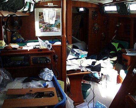
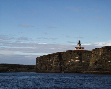
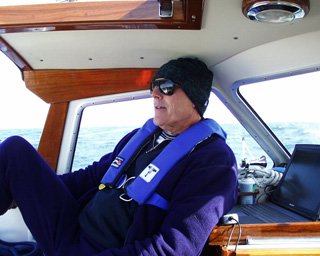
There was no final moment when we declared that everything was completed. Rather, the tools imperceptibly got packed away, empty boxes and packaging removed, and one by one the workers dropped off the boat. Our major projects were completed around 1400. But in reality the list of maintenance, repairs, and upgrades always go on. You just transfer remnants of the old list over to the clean page of a new one. We left Sound Rigging & Yacht Services at 1800. Along for the ride south is Dave Mumper from Gig Harbor, and Chris Thomerson from Eugene Oregon. Those of you continuing on from the Alaska trip recognize Dave as a previous crewmember, and sailor since the mid-50s. Chris Thomerson and I met on the route up to Alaska this past summer, when Chris was aboard Windrush II. Chris has sailed the North Sea East coast of Britain since age 12, and also participated in the National Championships out of Newport Beach California, to name a few of his proficient sailing abilities. We motored our way through Seattle's Ship Canal as the sun set on over Capitol Hill. All of us enjoyed the calm evening, and looked forward to our passage south. But the engine's temperature alarm disrupted our serenity only 40 minutes into our adventure. We immediately shut the engine off and opened up the engine room to find a pulley that had disconnected from the camshaft. Without the pulley, the water pump couldn't run. Without the water pump, the engine couldn't be cooled. A light breeze gave us the ability to sail, so we unfurled the headsail and aimed for an open dock at Canal Boat Yard. As we sailed in, I called Dan Dinsmore on his mobile phone. (Dan and Debbie will be joining Andanté in San Diego in a month.) By the time we sailed Andanté to the dock, tied her off, and opened the engine room doors, Dan arrived to help. With heads down and feet up in the air, Dan and I eventually found the pulley's three bolts that had come loose and scattered randomly on the floor of the engine room. Miraculously, the pulley and bolts weren't damaged, so Dan tightened them on again, rethreaded to water pump belt, and put us back in business. Repairs completed by 1740. We were on our way underneath the Ballard Bridge and through the locks. By the time we cleared the locks and entered Puget Sound, a very black night had set in. Next, we had to figure out how to get our new navigation software (ChartView) to drive the autopilot. Following instructions in the manual worked, and soon the software was driving the boat north towards Admiralty Inlet. The Strait of Juan de Fuca, Turning the Corner at Tatoosh Island Tuesday September 28 Chris took the first watch from 2200 to 0100. Dave came on next from 0100 until 0400, and I followed up from 0400 to 0700. With Chris at the helm on first watch, I tucked down under the covers of my berth, and began to fall off into a deep sleep. With only three hours sleep the previous night, I had been looking forward to this with great anticipation. Suddenly, however, Chris awakened me. It seems that our new navigation software was a little unstable and had crashed. We rebooted the system and started over again. Subsequently we discovered that these crashes occurred on a regular basis. To help work through this problem we moved the laptop into the cockpit, and everybody learned how to reboot it after each crash. I fired off some e-mail to the company in hopes that they can help us find a solution to this problem. Unfortunately, there are no opportunities for any software upgrades out here. At 0200 we passed Port Townsend, and then headed out of Admiralty Inlet into the Strait of Juan de Fuca. During the night, Dave and Chris discovered that the solenoid on the propane system wasn't working. How much fun: less than 24-hours after completing all repairs things start breaking again. We needed to fix the solenoid or suffer the consequences of not having any hot food for the duration of the trip. During my 0400 to 0700 watch, a bright full moon illuminated flat calm seas in a pure silver light. Wonderful conditions, considering that it had been blowing over 60 knots in the Strait just several days earlier. As we motored west I couldn't help but think about leaving almost 20 years of Seattle history behind. Seattle is where my daughter Erica grew up. It's a special place where I have so many wonderful friends. And it's where my professional career developed, working for companies like Chiat/Day/Livingston, the Seattle advertising agency that hired me from Chicago in 1982. After C/D/L I worked for another small advertising agency, Borders, Perrin, & Norrander. After the two local agencies I consulted mostly for small high-tech firms. My consulting led to a project with Microsoft. After that project Microsoft hired me full-time, and I spent seven very focused years there. I wonder if I will ever return to Seattle again for more than just a visit. And if so, when, and under what circumstances. I think about all the good friends that I leave behind, and when I might see them again. I wonder where my new life will lead me, where I will settle, if I will settle. Too many questions to adequately ponder. For the lack of any answers, I instead concentrated on pointing Andanté west through the Strait of Juan de Fuca, dreamt about turning left at Tatoosh Island, and hoped that the weather would support us along the way. Because we departed Seattle after all of the fuel docks had closed, we needed to make an important fuel stop before heading down the coast. At 1500 we took on fuel at Neah Bay, the last most westerly port in the Strait of Juan de Fuca. Neah Bay struck me as a cold lonely place, with no 'there' there. Fueling completed, we turned our attention to the propane system. Testing the electrical leads into the solenoid switch with a multimeter produced no current, even though the solenoid appeared to be fine. Chris suggested removing the firing pin from the solenoid, which worked. The only inconvenience: from now on we had to manually turn the propane tank valves on and off before and after each use. Inconvenient, but we could look forward to hot meals. We left Neah Bay around 1600 and passed in between Tatoosh Island and Cape Flattery about an hour later. Cutting the corner like this was remarkable, because normally the weather is so horrendous out here that passing between the island and the mainland is not something you want to even think about. It was a momentous point in the journey; both emotionally and geographically: clearing Tatoosh positioned us for sailing down the coast. We were officially on our way. South From Tatoosh Island The passage down the Washington and Oregon coasts is known to be among the most difficult in the Pacific Ocean. Only about 18 months ago the Coast Guard attempted to save two people in a sailboat that had been swept onto rocks near the shore. The Coast Guard's unsinkable rescue vessel flipped over (it's designed to right itself), but several crew members were swept overboard in the roll. This passage is not one to be taken lightly.
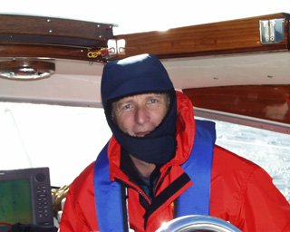
Imagine our surprise, however, to find the waters off the coast of northern Washington glassy-smooth. Not even a ripple. We motored through the night as if we had been sailing a sightseeing cruise around Lake Washington. Shortly after turning the corner, we were hailed by the 37 foot Tayana called Welcome Home. Welcome Home also planned to sail down to San Diego, and suggested radio checks throughout the night. Because we passed them, and would soon be out of range of the VHF marine radio, we agreed to contact each other on the single sideband radio (SSB). Similar to HAM radios, SSBs propagate signal off of the ionosphere. Unlike HAM radios, they don't require a license to operate, assuming you don't transmit on a HAM frequency. Wednesday September 29, 1999 0730, while slept snugly in my aft stateroom, Dave unfurled the genoa and shut the engine off. Finally, we were sailing the Pacific Coast. The wind built up to 20-22 knots throughout the day, althought the direction of the wind from the northwest prevented us from sailing a direct line south. Instead, we periodically gybed across our route line. I wrote this section at 1500 while we sailed a course of 133º at a speed of 7.6 knots over ground. We had blue sky above, and the air was crisp-bordering on cold-particularly because the main sail blocked the sun all afternoon on our starboard side. The 3-4 foot following seas pushed Andanté along and buoyed her up when they slid underneath her keel. We agreed that the only thing that could make this segment better is warmer weather. Thursday September 30, 1999 In the early morning dark, before moonrise, consistent 20-25 knot winds from the northwest drove us along at 7.5 and 8 knots. The 3-4 foot following seas had built to ten feet. We passed the occasional fishing boat and large container ship, using radar and the other ships' navigation lights to determine their course and direction. By sunrise we were out of sight of land. The Oregon Coast Earns its Reputation Friday October 1, 1999 Early morning, about 0200. I awoke to hear Andanté careening and shuddering off large waves. The instrument monitor mounted adjacent to my berth, indicated why, and I had to do a double-take: we were in 35-40 knot winds. I could hear Dave and Chris on deck, yelling above the noise of the wind, trying to manage the sails. About a minute later Dave appeared in the hallway leading to my stateroom, and requested my assistance in gybing. Once on deck, I asked for confirmation. Were we really in 40 knot winds? "Yes," Chris replied, "with gusts to 46." Definitely time to adjust the sails. We furled the genoa in completely, and reefed the main at 50%. Awake and ready to go, I just started my 0300 watch early, while Chris and Dave retired to the warmth of the cabin. Andanté sailed along at seven knots under reefed main in 32-35 knot winds. The following seas had built to 15 feet, and some of the larger ones broke onto our stern. First time for that. At 0400 the wind subsided to 25-30 knots, but the sea state had increased to 15-20 feet. Andanté handled the weather with style. We were actually sailing along comfortably, just not very smoothly. If the wave caught our stern directly behind us, we rode it along, sometimes surfing down the front, after which the bow pointed to the sky as the wave passed underneath. Occasionally a cross wave caught us from the side, pushing Andanté diagonally. As we slid off the wave, usually only a few feet, enormous splashes of foam built up on the downside part of the wave, cushioning our way. Then, as the wave passed underneath, Andanté would roll and slide down the backside. All this sliding made life uncomfortable below. Everything that we had secured made a clanging banging racket with each shift of the boat. Anything that wasn't tied down became a projectile. The object might sit placidly until an abrupt wave launched it into the air. Water bottles would levitate, and then aim for a point where they could do the most damage, like an unseen poltergeist throwing things randomly at whim.
We continued to experience these seas most of the day on Friday, but the consistent 20-30 knot winds made for great sailing. We were the only boat out there-about 35 miles from shore. Looking 360 degrees from the cockpit, you could only see dark blue seas swept with 10-15 foot white capped swells. It's a type of austere beauty that few people on earth will ever experience. Andanté sailed on without any concern. Up Next |
||||||||||||||
|
New Logs | All Logs | Route Maps | Links | Sponsors | What's New | Home | Contact | Search
|